maps & resources
Maps, Tallly Sheets, Leader Packets, FAQ, and More
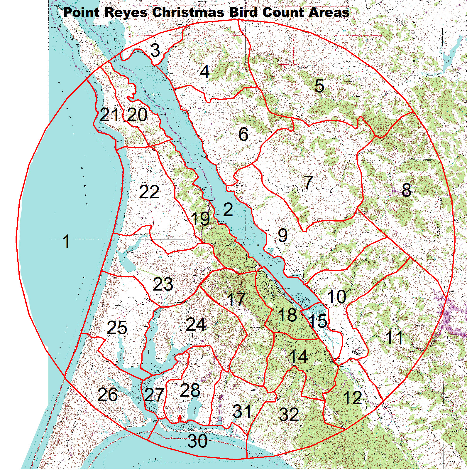
Area Maps
Click the area below to download the map.
1 Ocean
2 Tomales Bay Boats
3 Tom’s Point/Walker Cove
4 Nick’s Cove/Walker Cove
5 Chileno Valley
6 Cypress Grove
7 Verdi/Frink Ranches
8 Soulajule Reservoir
9 Marconi /Millerton
10 Pt. Reyes Station
11 Black Mountain
12 Olema Marsh
14 Inverness Park
15 Willow Point
17 Mount Vision
18 Inverness
19 Tomales Bay State Park
20 White’s Gulch
21 McClure’s Beach
22 Kehoe Beach
23 Abbott’s Lagoon
24 Home Ranch
25 Creamery Bay
26 Hall Ranch
27 Estero Trail
28 Drake’s Head
30 Limantour Beach
31 Muddy Hollow
32 Laguna Ranch


Tally Sheets
In order to keep things consistent and accurate we ask that everyone uses this same tally sheet for recording species out in the field, you are of course welcome to use your phones or other preferred method of tallying and transfer data to the sheet post count.